Cross-Industry
Join us! It's free!
Carbonix
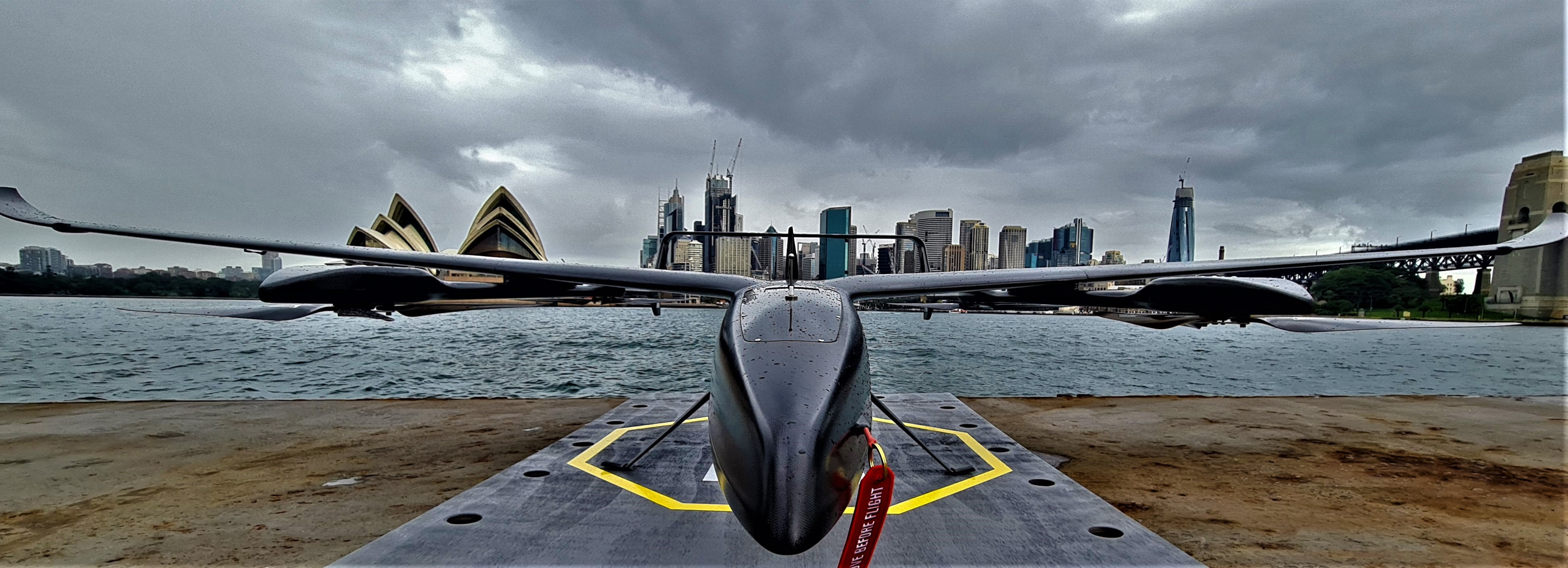
At Carbonix we advance the horizons of aerial data solutions to give our customers the competitive edge.
We are specialists in long range and large area aerial surveillance and precision data capture.
From national park conservation to detailed agriculture mapping and the aerial auditing of a 270,000km power network, Carbonix RPAS deliver mission success across a diverse range of industries with unrivaled stability, precision, and accuracy.
Capable of over 10 hours flight time and a customizable payload capability exceeding 5kg, our RPAS are engineered to accommodate challenging mission requirements.
Adapted to over 20 different sensors, we work with the most technically advanced ISR, LiDAR and photogrammetry systems to deliver unrivaled reach, efficiency, and accuracy of data.
Our commitment to differentiating by design reflects our foundation in competitive yacht racing.
We are tenacious in our pursuit of design excellence. The aesthetic beauty of our products is an expression of their functional purity.
Our uncompromising standards deliver unchallenged performance.
This commitment to continuous testing and refinement ensures we are always evolving. By continually advancing the boundaries of what is possible we obsessively fine-tune every detail, to apply a simplicity and sophistication to everything we do.
Our network of global partners enables access to our team of approved specialists wherever you are. Ensuring efficiencies of investment and adaptability to accommodate bespoke requests or end-to-end solutions, we adapt to your mission challenge and empower you to achieve it.